You know, the construction and surveying worlds are changing pretty fast these days, mainly thanks to new tech. One big game-changer is Portable Rtk (Real-Time Kinematic) systems. I recently read a report from MarketsandMarketsthat says the Global Gnss market is expected to jump from around$196 billion in 2020 to over $322 billion by 2026 — that’s an annual growth rate of about 8.3%. A big reason for this boom? People really need more accuracy and efficiency when doing fieldwork, and portable RTK tools are totally transforming how things get done. 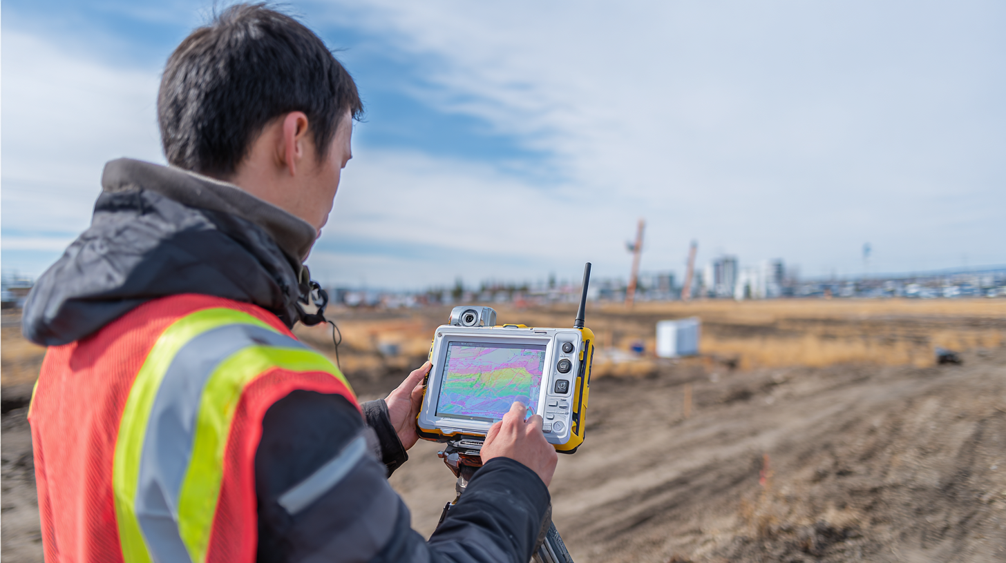 At Shanghai Apekstool (APEKS), we totally get how big of a deal these tech advancements are, especially for surveyors and construction pros. We’re committed to helping you level up with the latest GNSS/GPS gear and custom solutions that make your projects smoother and faster. In this guide, I’ll walk you through some key tips to successfully implement Portable RTK, so you can stay ahead of the game in this competitive industry.
Key Benefits of Portable RTK Technology in Surveying and Construction
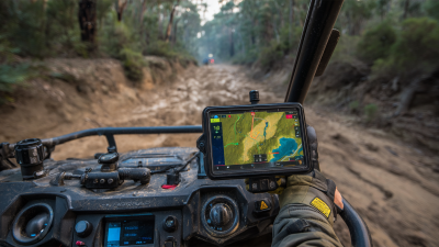
Portable RTK (Real-Time Kinematic) tech has really become a game-changer in both surveying and construction work. I mean, it’s now possible to get pinpoint accuracy—something that used to seem out of reach—changing the game from meters to just centimeters. And what's cool is that these portable solutions aren’t just super accurate; they’re also pretty budget-friendly and quick to deliver results. For example, when you integrate RTK with drone mapping, it allows operators to whip up detailed, high-res maps on the spot, making data collection way more efficient. Thanks to advancements like the NTRIP protocol, surveyors are seeing real-world benefits over the traditional RTK and DGPS methods—making their workflows smoother from start to finish.
**Pro tip:** When you’re setting up Portable RTK, double-check that your gear plays nicely with your existing systems. That way, you get the best accuracy without wasting time fiddling with compatibility issues.
Adding RTK tech isn’t just about better data—it can actually save you a ton of time and money. From what I’ve seen, drones equipped with RTK don’t just collect info faster—they also boost safety since there’s less manual work involved. Plus, the RTK network offers seamless, real-time data sharing, which is a total lifesaver for site analysis and making quick, solid decisions.
**Another tip:** Make sure your team gets regular training on RTK tools. It really pays off because everyone can then use these technologies like a pro and get the most out of them.
Maximizing Efficiency: Key Benefits of Portable RTK Technology in Surveying and Construction
Essential Hardware Requirements for Effective RTK Implementation
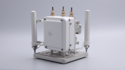
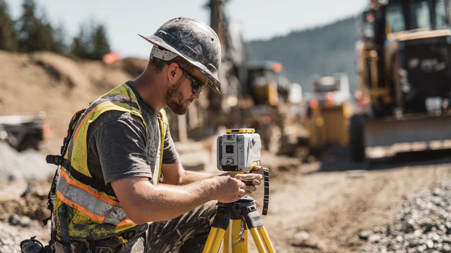
When you're setting up Real-Time Kinematic (RTK) technology for surveying or construction, it’s super important to get the hardware right if you want everything to run smoothly. Basically, the starting point is a solid Gnss Receiver. It needs to handle signals from all the major satellite systems like GPS, GLONASS, Galileo, and BeiDou — that way, you’ll get better accuracy and more reliable data. If you can swing it, going for a dual-frequency receiver is a game-changer. It improves correction capabilities, especially in tougher spots where signals might get blocked or disrupted.
Aside from the receiver, having a good communication setup is a must. Whether it’s a strong cellular network or a radio link for sending corrections, your RTK system depends big time on this real-time data exchange between the base station and the rover. Oh, and don’t forget about the tripod and pole! Picking the right ones can seriously make a difference in how steady and precise your measurements are. Lighter materials that are still tough and durable? They’re perfect because you can transport them easily but they won’t sacrifice stability. Put all these hardware pieces together, and you’ve got a solid foundation for making your RTK deployment in any survey or construction job pretty efficient and reliable.
Best Practices for Setting Up Portable RTK Systems on Site
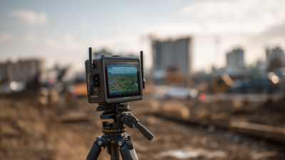
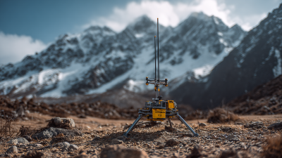
When you're setting up portable RTK systems for surveying or construction work, getting everything right from the start can really make a difference—both in terms of accuracy and how smoothly things run on-site. One of the most important things to think about is where you place your base station. Ideally, find a spot on stable ground, away from big obstructions like buildings and trees, because that helps cut down on signal issues. Going for a high point can also help, since it gives a clearer line of sight to satellites, which means better data reception.
Before diving into the full job, it’s a smart move to do some thorough testing. Use simulation tools if you’ve got them, to double-check that your equipment is calibrated properly and that the connection between your base and rover is solid. Taking a little extra time upfront to do these checks can save you a lot of headaches later—spotting potential problems early on means you won't waste time fixing things in the middle of the project.
And of course, good communication within the team is key. Make sure everyone knows their role, understands how the gear works, and has clear protocols for tackling any tech problems that pop up. When the team stays on the same page, things tend to go smoother, downtime is minimized, and your Rtk Setup actually works at its best out in the field. It’s all about teamwork and staying connected—makes a world of difference!
Integration Strategies for RTK with Existing Surveying Equipment
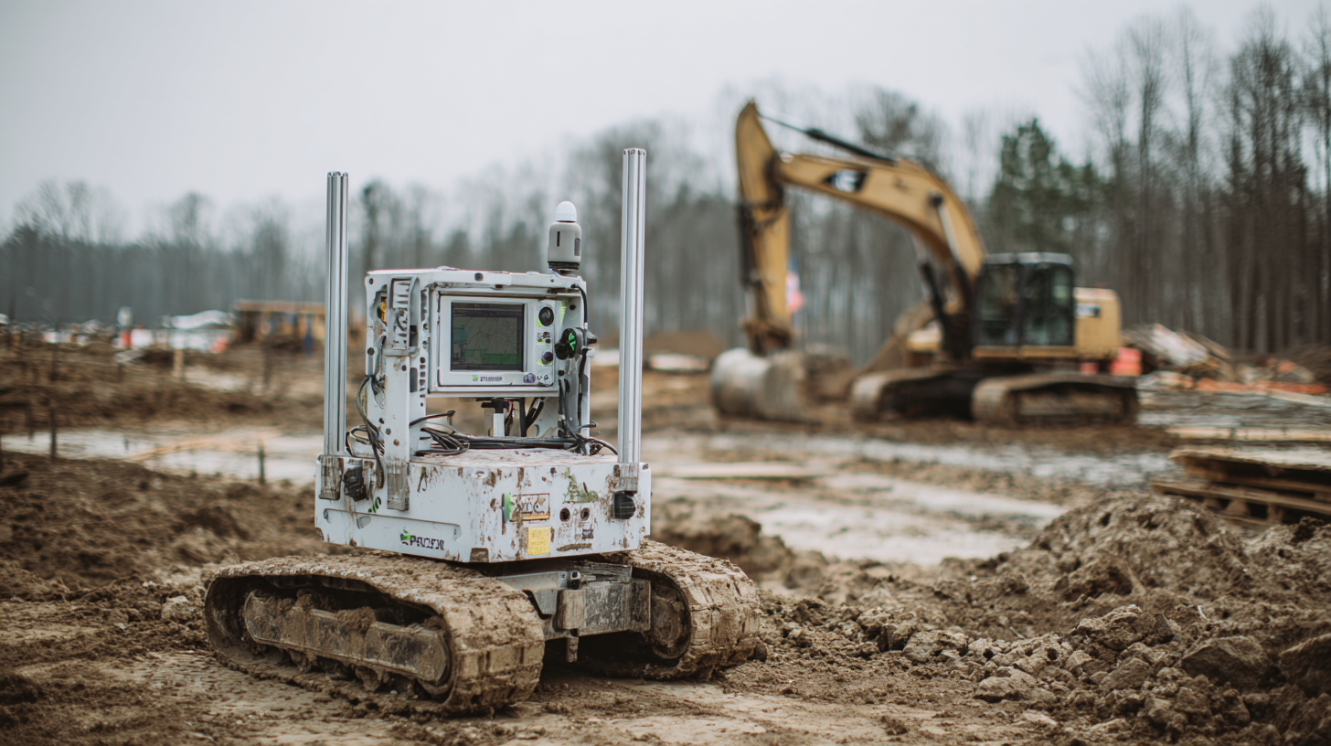
Mixing Real-Time Kinematic (RTK) technology with your current surveying gear is a total game-changer when it comes to boosting accuracy and saving time on both surveying and construction jobs. The trick? Upgrading your surveying software and apps can make all the difference—they’re like the glue that ties everything together smoothly. Recent leaps in GNSS and inertial positioning tech have introduced tools that not only make data collection easier but also sharpen the analysis side of things. These innovations help you streamline your workflow and let you adapt faster to whatever new challenges your projects throw at you.
And don’t forget about GPS integrity modules—these are super important for keeping your positioning on point. They make RTK corrections more reliable, cutting down errors and giving you consistent results. By adding these smart features to your existing equipment, you're basically unlocking their full potential. It’s all about creating a comprehensive setup that boosts data reliability and makes your workday more efficient. As surveying tech keeps improving, staying in the loop with the latest tools is key for pros who want to keep their processes sharp and up-to-date.
Enhancing Data Accuracy and Reliability with RTK Techniques
You know, in the constantly changing worlds of surveying and construction, getting data as accurate and dependable as possible is a big deal. Lately, there’s been some pretty exciting progress with high-precision positioning thanks to Global Navigation Satellite Systems—stuff like RTK. And honestly, that centimeter-level accuracy isn’t just a fancy bonus for traditional surveys; it’s a game-changer for emerging tech like self-driving cars and service robots, where knowing exactly where they are is super important for everything to run smoothly.
On top of that, people are now blending different sensors with clever algorithms—think about combining Extended Kalman Filters with Recurrent Neural Networks—to make RTK even better. This kind of AI-powered approach can really help tackle some of the old challenges, giving surveyors and builders more trustworthy data.
Plus, with new tools like UAV-mounted LiDAR and multispectral measurements coming into play, the way we gather and use data is changing fast. All of this just goes to show how vital RTK is becoming for mapping terrains and planning projects more accurately and efficiently.
Future Trends in RTK Technology for the Construction Industry
The construction world is really at the brink of a tech revolution lately, especially with all these new advances in Real-Time Kinematic (RTK) tech. As projects get more complex and demand higher precision and speed, everyone’s looking toward smarter, more autonomous systems to help out. One cool development I’ve seen is the use of RTK networks that run on cloud platforms — this makes sharing data a lot easier and keeps everyone updated in real time, even across multiple sites. It’s a game-changer because it speeds things up, cuts down on delays, and helps construction crews finish jobs quicker and more accurately.
And let’s not forget how AI and machine learning are starting to shake things up in the field. These fancy tools are analyzing huge amounts of data, which means smarter decision-making and smoother workflows right on site. For example, AI can spot potential problems before they even happen, so teams can fix stuff early instead of dealing with surprises later. As RTK tech keeps evolving, it’s also getting more tied into drones and autonomous machinery — all of which is making everything faster, smarter, and even more sustainable. Seems like the future of construction is pretty exciting, right?”
Maximizing Efficiency: Essential Tactics for Portable RTK Implementation in Surveying and Construction - Future Trends in RTK Technology for the Construction Industry
| Tactic | Description | Expected Impact | Future Trends |
| Mobile RTK Systems | Utilizing portable RTK systems for field surveys to improve data accuracy and reduce time. | Increased efficiency and precision in surveying tasks. | Integration with IoT and real-time data processing. |
| Cloud-Based Solutions | Leveraging cloud platforms for data storage and sharing to enhance collaboration. | Improved team productivity and data access. | Growing reliance on cloud integration for project management. |
| Real-Time Feedback | Implementing systems that provide immediate feedback on measurements and positions. | Reduces errors and rework rates in construction projects. | Increased use of augmented reality for real-time data visualization. |
| Data Analytics | Applying data analytics to optimize ing workflows and predict site conditions. | Enhanced decision-making through data-driven insights. | Greater emphasis on machine learning algorithms in surveying. |
FAQS
: Portable RTK (Real-Time Kinematic) technology enhances standard GPS accuracy from several meters to mere centimeters, providing precise data for surveying and construction.
It delivers fast, high-resolution mapping and data collection, reduces manual interventions, and increases overall site safety and efficiency.
Essential hardware includes a high-quality GNSS receiver capable of processing signals from multiple satellite systems, a robust communication system for data transmission, and stable tripods and poles.
Dual-frequency receivers improve correction capabilities and performance, especially in environments with signal obstructions.
Drones equipped with RTK functionalities expedite data gathering, enhance safety, and enable real-time data exchange for improved decision-making.
Regular training ensures that all team members understand how to effectively use RTK technologies, improving overall team performance.
The NTRIP protocol allows for notable practical benefits over traditional methods, enhancing operations by enabling seamless connectivity and real-time data exchange.
Incorporating RTK leads to significant savings in time and operational costs, streamlining various project stages and reducing manual labor.
Ensuring equipment compatibility with existing infrastructure maximizes accuracy and minimizes setup time during implementation.
Lightweight and durable materials facilitate easier transport while maintaining measurement stability and accuracy.
Conclusion
In today’s fast-moving world of surveying and construction, finding ways to work smarter and faster isn’t just a luxury — it’s a necessity. That’s where Portable RTK technology really shines; it’s like having a game-changing tool right at your fingertips. This innovative tech offers some pretty big perks, like better data accuracy and a real boost in onsite productivity. Of course, to get the most out of it, you’ll need solid hardware—think reliable GNSS/GPS systems and compatible surveying gear. Getting these set up properly really makes all the difference, ensuring everything works smoothly together so surveyors can trust their data and make those precise measurements with ease. Looking ahead, it’s exciting to see how trends in Portable RTK are set to evolve, promising even more breakthroughs that will totally transform how we do surveying and construction work. Here at Shanghai Apekstool (APEKS), we’re all about providing the latest in geospatial surveying tools to help push these innovations forward."